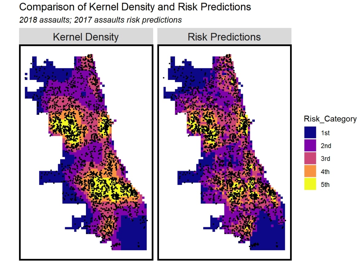
In this project, I developed a geospatial risk model using R to predict future simple assaults in the City of Chicago, focusing on spatial and temporal patterns of criminal activity. Using historical crime data from 2017, I incorporated risk factors such as proximity to Metra stations, POD cameras, liquor retail locations, and streetlight outages. The analysis combined regression modeling, kernel density estimation, cross-validation, and spatial feature engineering to generate predictive risk maps. I also used Local Moran’s I to assess spatial clustering and built models with and without spatial processes to evaluate predictive accuracy. Results showed that spatial features improved model performance, but also exposed limitations and racial bias—particularly underprediction in non-white neighborhoods. This project demonstrated both the technical potential and ethical complexity of using spatial analytics in data-driven public safety planning, emphasizing the need for careful variable selection and transparency in predictive policing applications.